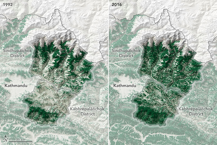
These maps show forest cover in Kābhrepalāñchok (Kabhre Palanchok) and Sindhupālchok (Sindhu Palchok), districts in the Bagmati Province east of Kathmandu. These districts were the focus of recent regional land cover change analysis because of their early adoption of community forestry. Beginning in the 1980s, the Australian government financed tree planting projects in these districts as well as the development of community forest groups. In many of the community forests, active management allowed trees to grow back naturally in the hills, but tree planting efforts were needed in lower elevation areas that were largely devoid of vegetation.
One community forest (called Devithan or sacred grove in Nepali) lies to the east of Kābhrepalāñchok. Using Landsat data dating back to 1988, the research group found that the Devithan community forest had only 12 percent forest cover in 1988, which grew to 92 percent in 2016.
Although the Devithan community forest wasn’t a formal community forest until 2000, the community organized into an informal community forest management group (with laws limiting grazing and fuelwood collecting) after the 1993 forestry act. The study found that trees and vegetation rapidly regenerated, expanding canopy cover and the availability of fodder within the first few years of informal management. Within the boundaries of this community forest, about 25 percent of total forest regeneration happened before Nepal’s forest rangers formally recognized them as a community group.
Add new comment